
Walk a Harvey Street by Address
Begin with the printed street address, not a person's name. Harvey is an unincorporated community in Jefferson Parish, so the authoritative trail sits with parish and state offices rather than a Harvey city hall. A parcel is the mapped unit of land used by the Assessor and GIS. It gives the search a stable key when spelling, unit numbers, mailing labels, or old street text differ.
The goal is a chain of evidence, not a list of assumed occupants. The Assessor can display a primary owner and tax mailing address. A deed names parties to a recorded transfer. A voter entry reflects registration at a date. None alone proves who was inside a Harvey home on that day.
- Normalize the address and ZIP with USPS, then search JeffMap. If the address fails, try the nearest intersection or subdivision.
- Identify the parcel. Record its parcel ID, physical address, legal description, subdivision, block, lot, and the map date.
- Open the Jefferson Parish Assessor search. Compare the physical address, mailing address, owner display, and deed clues without treating the result as a household roll.
- Use eClerksLA or JeffNet to follow a defined deed or instrument. Match the legal description, instrument number, book/page, dates, and party roles.
- Check a named voter through Louisiana's four-field lookup only when relevant. For an older household, turn to a dated criss-cross directory, census image, newspaper, or obituary.
Keep a simple log: date, address or parcel, source, named role, record number, and confidence. That makes conflicts visible and prevents an old or tax-only name from being presented as a current Harvey resident.
Map Harvey Streets in JeffMap
Jefferson Parish Planning says JeffMap accepts an address, nearest street intersection, or subdivision. A building result appears at the left, while selecting a parcel returns parcel information. The viewer also offers layers, a legend, property identify, measurement, buffer, and print controls. Useful layers include streets, structures, parcels, subdivisions, blocks, canals, zoning, and land use.
The parish map instructions show how those tools work. Harvey is within the unincorporated area covered by the map, unlike several incorporated Jefferson Parish cities excluded from its scope. Still, the map is current geographic evidence, not a historic street index or an official zoning determination.
The parish's illustrated instructions show the search and parcel-selection workflow:
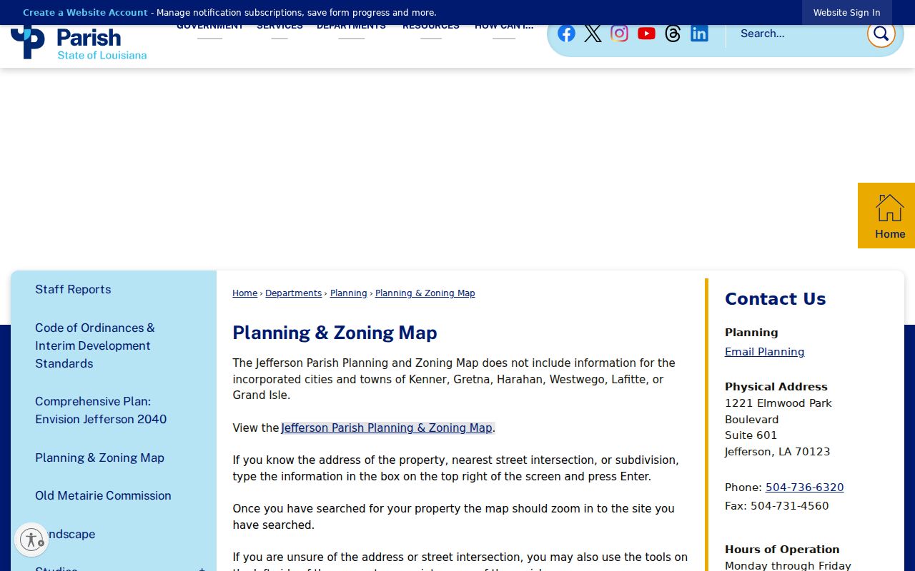
Use the image to locate map controls, then record the parcel ID and map date from the live viewer before relying on a boundary.
Note: Planning, not the map alone, must give an official zoning determination for a Harvey parcel.
Search Harvey Parcels Precisely
The Assessor portal is the main bridge from street text to a parcel record. Its search choices are narrow and useful. Once a parcel number is found, it is more reliable than repeating a name search. A returned mailing address can belong to a tax contact elsewhere, so compare it with the physical address and legal fields.
| Search field | Input | How it helps |
|---|---|---|
| Owner | Last,First with no space | Finds a parcel by displayed owner when the name is known. |
| Property Address | Street address | Connects a Harvey address to the tax parcel. |
| Parcel # | Parcel identifier | Provides the strongest stable key after the first match. |
| Subdivision | Subdivision name | Helps when a street spelling or number does not resolve. |
| Search / Reset | Controls | Runs or clears the query; required fields are not stated. |
A parcel detail may show the primary owner, physical and mailing addresses, ward, legal description, assessed and market values, deed number and date, homestead display, subdivision, block, and lot. The 2026 roll is marked preliminary until state finalization. Record that status with any result.
Harvey Street Records Compared
A useful Harvey street directory separates each name by its role. The same address may return an owner, deed party, voter, permit applicant, contractor, or past directory occupant. The source and date determine what the name means.
| Address record | Keeper | Evidence shown | Access channel |
|---|---|---|---|
| Parcel card | Jefferson Parish Assessor | Owner display, physical and mailing address, deed clue, legal fields | Public search; office or written roll request |
| GIS map | Jefferson GIS/Planning | Parcel, structure, street, subdivision, canal, zoning and land use | JeffMap; Planning contact for official zoning |
| Mortgage and conveyance | Jefferson Parish Clerk | Grantor, grantee, instrument, dates, description, book/page | Free index; paid image; free counter inspection |
| Voter record | Louisiana SOS and parish registrar | Named registration and address fields under legal limits | Four-field lookup or regulated purchased list |
| Permit or code file | Jefferson Parish departments | Project, inspection, complaint, status, and public participants | Portal, tracker, or narrow public-record request |
| Historical directory | Libraries and archives | Dated name, address, phone, or cross-reference | Print, microfilm, database, or staff request |
The parcel number and legal description join the strongest property sources. Street text is still useful, but it is less stable across old records. Never collapse these roles into a single claim about who lives at a Harvey address.
For a street-wide project, repeat the parcel check one address at a time. Do not infer a missing house number from the parcel beside it. Canals, side streets, vacant lots, and subdivision lines can break what looks like a simple row on screen. Save a dated map print and list each confirmed parcel separately. If the question concerns a whole tax roll rather than a few addresses, the Assessor describes a written request for a one-year roll, with its own stated fee and delivery process.
Follow Harvey Deeds by Parcel
The Jefferson Parish Clerk is the recorder for mortgages and conveyances. Its records include transfers, mortgages, liens, judgments, releases, plats, trade-name affidavits, and related instruments. The electronic mortgage and conveyance index starts in 1967. Older index images cover 1825 through 1966, and the Clerk describes document images from 1825 forward.
Search the free statewide eClerksLA index by grantor or grantee, dates, instrument number, description, book/page, and document type. A grantor transfers an interest; a grantee receives it. JeffNet supplies remote image access through paid options, while physical inspection at the Clerk's Gretna research room is free during weekday public hours. Copies and certification cost extra.
The Mortgage and Conveyance office page explains the recorded series and access routes:
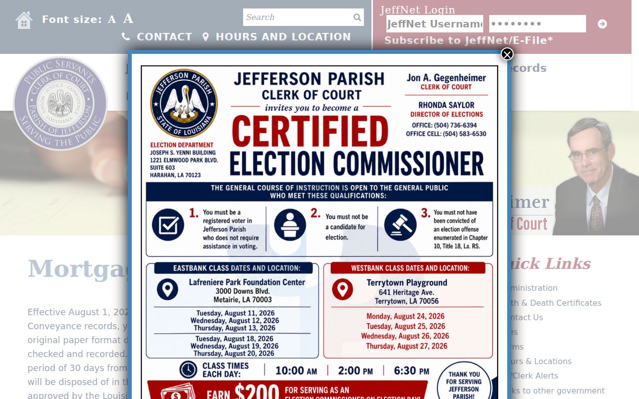
The capture provides the official starting point; a street investigation still needs the actual instrument, legal description, and party roles from the matching record.
Note: A deed chain documents recorded property events, not every Harvey occupant, renter, visitor, or person who received mail.
Harvey Permits Add Address Dates
Building and code records can add dated events after the parcel is known. Jefferson Parish Building Permits handles West Bank work through its Marrero office. Online permit tools may show an application or project status, while the service-request tracker accepts an address, service ID, or complaint number. Coverage dates were not published in the inspected sources.
If no usable online result appears, send a narrow request through the Jefferson Parish public-records route. Give the exact address or parcel, department, record type, and date range. Ask for permits, inspections, certificates, or code files, not every file tied to a person. Louisiana law allows inspection of public records, subject to exemptions and reasonable copy or transmission fees.
The parish request page shows the official route and the information needed to direct a request:
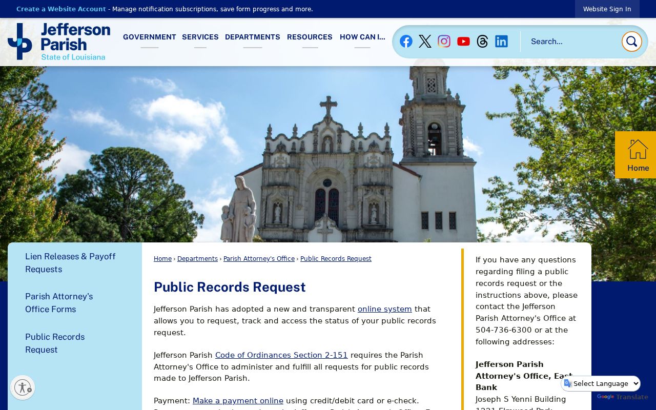
This fallback matters when a permit or complaint tracker has no clear historical span or a supporting document is not posted.
Harvey Street Labels Can Mislead
USPS materials support Harvey postal labels 70058 and 70059, but a ZIP is a delivery geography rather than a legal boundary. A Harvey mailing label may serve an address outside the Census-designated place, and an office used for Harvey records may have a Gretna, Marrero, or Jefferson postal address. Verify the street first with USPS, then confirm its parcel and parish geography in GIS.
No official Harvey street-renumbering crosswalk was found. The New Orleans archive has street-name and number-change indexes for New Orleans, but those cannot be applied to Harvey. When old street text fails, preserve the printed form and compare subdivision, block, lot, deed description, historic map notes, and adjacent records. Mark any old-to-new match as unconfirmed until two sources agree.
Harvey Voters Are Name Searches
The Louisiana voter portal is not a browse-all-streets tool. It asks for first name, last name, ZIP code, and birth month/year. Use it to check a known person, not to compile everyone along a Harvey street. A purchased voter file may include residence and mailing address fields, ZIP and ZIP+4, ward, precinct, districts, status, registration date, and history, but it is a regulated product with charges and statutory restrictions.
Protected data includes Social Security and driver-license numbers, several birth-date and contact fields, minor applications, and Address Confidentiality Program physical addresses. A substitute address may therefore explain a mismatch. Treat any voter hit as a dated registration record, and confirm identity with another lawful source.
Read Harvey Address Terms
Four labels prevent many street-directory errors. They should be copied exactly as the source prints them and compared, not forced to match.
- Parcel
- A mapped tract used by the Assessor and GIS, identified separately from a person's name.
- Situs address
- The physical location of the property, which may differ from the owner's mailing address.
- Plat
- A recorded map that lays out subdivisions, lots, blocks, streets, or easements.
- Criss-cross directory
- A historical directory arranged by address or phone so a researcher can work from place to name.
A legal description can outlast a street number. That makes subdivision, block, lot, and prior deed references vital when tracking an older Harvey address.
Harvey Streets Across Past Years
For a defined historic year, a criss-cross directory can connect an address to an occupant or phone entry. Geographic coverage must be checked issue by issue. The New Orleans City Archives lists a 1955 R.L. Polk suburban directory and a 1966 Haines CrissCross run as promising West Bank bridges, but it does not say that every Harvey street appears.
Pair a directory line with a census sheet, newspaper image, obituary, deed, or parcel clue. Federal census schedules are open through 1950 under the 72-year release rule. The NARA directory method can turn a street address into an enumeration district, which is the census search area. Full collection details belong in the Harvey city directory history.
Note: Photograph or record the volume title, year, page, and abbreviation key before citing a historical Harvey address entry.
Limits of Harvey Street Records
No official source provides a complete list of everyone present at a Harvey address. A tax mailing address may be elsewhere. A deed party may be a former owner, trust, or business. A permit can name a project participant. Voter records can be stale or protected, and old directories are snapshots compiled before publication.
Conflicts should remain visible. If USPS, JeffMap, the Assessor, and a deed print the same location in different ways, preserve each form with its source date. Resolve the parcel through legal description and map evidence, then state what remains uncertain. That is more accurate than choosing the label that looks most familiar.
Utility customer lists were not found as public Harvey records, and motor-vehicle address data is restricted. Commercial compilations can mix old public and private data with weak identity matches. Use official records for a defined question, keep dates and roles attached, and avoid publishing bulk address lists.
Lawful use. Harvey address records are for lawful personal research. Never use a street directory to stalk, harass, intimidate, or expose protected locations.