
Harvey Block Records Compared
A neighbor question can mean the lots sharing a boundary, the homes on one street segment, or the wider civic area. Define that boundary first. Harvey is an unincorporated West Bank community, so parish sources provide the official parcel and land layers. Each record below answers a different part of the block question.
| Source | Block Detail Supplied | How to Reach It |
|---|---|---|
| JeffMap | Parcels, roads, structures, canals, blocks, zoning, buffer, identify | Public web viewer; map date should be noted |
| Parish Assessor | One parcel’s owner display, physical and mailing address, legal fields | Public search by address, parcel, owner, or subdivision |
| Clerk land index | Recorded parties and instruments for a selected parcel | Free index, paid image, or free counter inspection |
| Voter records | Named lookup or regulated file with address and district fields | State lookup or purchased list under statutory limits |
| Parish civic directory | Public association names and selected contact details | West Bank category directory; not a membership roll |
| Library and archives | Dated directories, newspapers, maps, and local collections | Issue-specific online, card, microfilm, or staff route |
The strongest default output is a dated map of parcel relationships plus public place and civic information. Do not turn the result into a roster of natural-person names. Mailing addresses, deed parties, voter registrations, and old directory entries each reflect a distinct event or status.
Map Harvey Neighbors by Parcel
The JeffMap viewer exposes Property Identify Info, Layers, Legend, Buffer, Measure, and Print Map. Its buffer can begin with a property parcel or a drawn polygon and accepts feet, yards, miles, meters, kilometers, or nautical miles. A buffer is a research aid, not a legal definition of neighbor. Parcels directly touching the subject lot provide the clearest start.
- Search the subject address, nearest intersection, or subdivision and select the correct parcel.
- Record its parcel ID, street label, subdivision, block, lot, and the date the map was checked.
- Turn on useful layers for parcels, streets, structures, canals, zoning, and land use.
- Identify each adjoining parcel separately. Do not infer a shared line from screen position alone.
- Run each selected parcel through the Assessor and keep owner, mailing address, and physical address as separate fields.
- Use the Clerk only for a defined deed or instrument question, not a bulk list.
A canal, road, or noncontiguous lot can fall inside a circle without being next door. State the physical feature between parcels. For a full named-street chain rather than the immediate block, use the Harvey street directory method.
Read Harvey’s Block Geography
Harvey’s land pattern makes map context important. The Mississippi River divides Jefferson Parish’s East and West Banks, while the Harvey Canal crosses established residential, commercial, and industrial areas. A search result may also use Harvey, Marrero, Gretna, a subdivision, ward, or postal city label. Those are clues to reconcile, not automatic synonyms.
JeffMap includes unincorporated Harvey, but the planning page says several incorporated cities are excluded. Check a near-boundary parcel against the Assessor and parish profile. Zoning shown on the map is informational; Planning gives an official determination. Historical research needs dated deeds, plats, directories, or maps because the current viewer states no historic coverage date.
The captured West Bank civic directory shows the public community layer around Harvey neighbors.
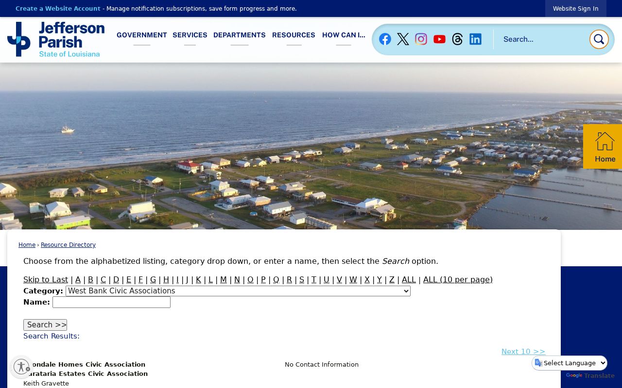
The entries are community anchors. They do not define parcel boundaries or disclose who belongs to an association.
Note: Cite the viewer and check date because parcels, structures, planning layers, and public contacts can change.
Harvey Neighbors and Civic Groups
The parish directory identifies two useful Harvey contacts. Baywood Neighborhood Association is listed with a Harvey post-office box and a public president and phone. Greater Harvey Civic Association is listed with a public contact and Harvey street address. Verify current details on the live West Bank civic-associations directory before relying on them.
Baywood Neighborhood Association
Public parish-directory entry for a Harvey community group. Use its listed contact to ask about meeting or area information, not for a private member roster.
Greater Harvey Civic Association
Public civic contact and meeting clue for Harvey. The listing does not prove that any person or parcel is a member.
The category also contains organizations from Avondale, Barataria Estates, Bellemeade, Bridge City, Crown Point, and other West Bank areas. Its geography is broader than Harvey and was not shown to be exhaustive. No public congregation, block-watch, private-club, or HOA membership roster was found. Public contacts and meeting places are appropriate; private names are not.
Harvey Voter Data Is Narrow
The Louisiana voter lookup requires first name, last name, ZIP code, and birth month and year. It is not a browse-by-street screen. A purchased voter file may contain residence house number, street, apartment, city, ZIP, ward, precinct, district, registration date, status, and voting-history fields, but the product has a cost and legal restrictions.
Louisiana R.S. 18:154 protects Social Security numbers, driver-license data, specified birth-date components, email and phone categories, minor applications, Address Confidentiality Program information, and other listed fields. Do not publish a block’s voter names and addresses as a directory. Use a voter result only for a documented, specific lookup, label it as registration data checked on a date, and never treat it as proof that the person is present now.
The default public layer for Harvey neighbors remains parcel shape, roads, canals, public sites, civic groups, and source links. That keeps the block useful without exposing a regulated file.
Verify Harvey Neighbor Sources
Official sources are narrower than compiled commercial tools, but their field labels and custodians are clear. Commercial neighbor products may merge stale public and proprietary data with uncertain identity matches. They can be a lead at most. Never publish their inferred household lists or assume that a matched name still lives at the address.
| Source Type | Strength | Key Limit |
|---|---|---|
| GIS and Assessor | Parcel geometry and current tax-roll display | Owner and mailing address are not a household roster |
| Clerk index and deed | Recorded instrument, parties, date, legal description | A deed event does not prove current occupancy |
| Official credential or business search | Public status, entity, or filing affiliation | Business address and agent role do not establish residence |
| Commercial compilation | May collect broad leads | Unknown refresh dates and variable identity matching |
The captured Louisiana Commercial Database illustrates an official filing search.
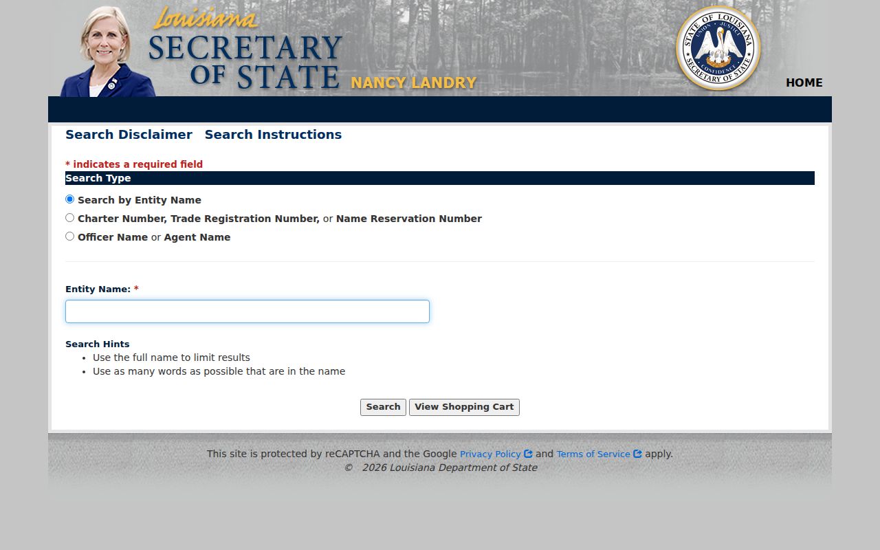
An officer, agent, or business address is a filing fact. It should not be converted into a claim about a Harvey household.
Harvey Public Roles Differ
A public credential may confirm that a name is associated with a regulated activity, yet it answers a different question from a neighbor search. The Louisiana Real Estate Commission search accepts license type or number, company, name, phone, address, ZIP, city, and state, with a like-sounding-name option. Use it to verify official license status or public affiliation only.
The captured form shows why field meaning matters before two records are joined.
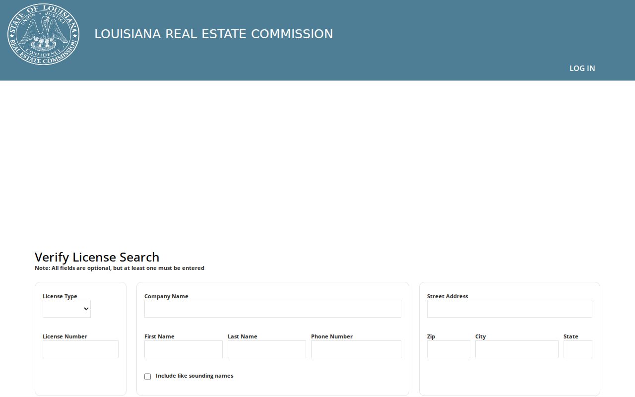
An address returned with a license may be an office or public contact address. Match it to a parcel only when the specific research question calls for that comparison, and retain the role label.
This distinction also applies to a permit applicant, contractor, registered agent, deed party, and association contact. Each can be connected to the block without being one of the current Harvey neighbors.
Request Harvey Address Records
When a permit, code case, or planning file is not fully searchable, use the Jefferson Parish public-record portal. Ask for one record series tied to an exact address or parcel and a defined date span. State whether inspection or copies are wanted and request a fee estimate. The parish page lists a records contact at 504-736-6300 and directs requesters to its current online system.
A useful request seeks building permits, inspections, and certificates for a property during stated years, or identifies the public file for a known complaint number. It should not demand all data about everyone on a block. Under Louisiana Public Records Law, inspection of public records is free, although reasonable copy or transmission fees may apply and exemptions still control.
Note: A service complaint describes an issue and response, not every person living near the reported address.
Protect Harvey Neighbors’ Privacy
Public records do not produce a complete list of people present at an address. A tax mailing address can be elsewhere. A deed party can be a prior owner, estate, trust, or entity. A directory can be old, and a voter record can be stale or protected. Utility customer and delivery records were not found as public Harvey sources. Federal law also restricts motor-vehicle address data.
Louisiana’s Address Confidentiality Program supplies a substitute address while keeping a participant’s physical location confidential. Protected-person redaction can also explain a missing field. Never try to reconstruct those addresses from parcel, voter, court, or commercial fragments. Describe the block through verified geography, public organizations, parks, streets, canals, subdivisions, and dated record roles.
Lawful use. Learn about Harvey neighbors for civic awareness, reconnection, or personal safety. Do not watch, intimidate, harass, or expose any person.